Showing posts with label Grand cities. Show all posts

Sunday, January 2, 2011

Sleepycity - urban exploration

Cities are full of left-over places, abandoned places, places that people aren’t really meant to go to but can be reached by the suitably determined.  These places are very attractive to a certain sort of person – people who are just plain curious about the cities around them – who then explore these urban environments to see what can be found when we peel back the skin of the city. 

Sleepycity is the photo blog of one such group of explorers who combine insatiable curiosity with a taste for high-class photography.  The result is a collection of fabulous images that underline the strangeness, the otherworldliness, of places that are just below, over, or beside the commonplace world we live in.  The result is something like a modern fairy story, the old kind of fairy stories where they steal children rather than sip tea from buttercup blossoms: they too were about magical worlds that were always nearby, but just out of reach.

I won’t do more here than scratch the surface of their collection to encourage you to go there and see for yourself.

The now undergrounded River Fleet in London

Atop a bridge in New York

An abandoned NASA rocket test-firing site

Apart from a wonderful store of images that could help illustrate a game, the nature of these urban explorers is also very interesting.  Insatiably curious people are the fundamental kind of character for a Lovecraft story, indeed any kind of “investigative” tale.  Of course, in any of these stories the curious people are liable to find more than they bargain for (in Lovecraft’s work, being curious is almost a death sentence).

Perhaps a group of such explorers has learned of something terrible in their city and are now being hunted down; the characters have to find these people, learn why they are being picked off and put an end to it.  No easy task when both the hunters and the hunted are so adept at not being caught!  Alternatively, perhaps such a group of explorers are a source of information for the characters, telling them how to access parts of the city that may be off—limits to others.

Thursday, November 25, 2010

Caves and cities

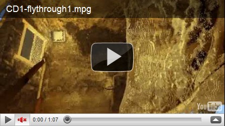
BLDGBLOG recently pointed to a survey of the caves under the city of Nottingham.  Using laser imaging, they are producing incredibly detailed 3D maps of caves that have been dug into the sandstone beneath the city.  The caves range from Medieval escape routes (such as Mortimer's Hole), to Victorian “gentleman’s caves” (enlarged cellars where they could host dinner parties).  But all were dug out rather than natural – something that was possible because the stone beneath the city is stable but comparatively soft.

Mortimer’s hole is particularly interesting because it is the real deal for fantasy gamers.  This is what a tunnel from the middle ages really was like, and I must say it’s not far off what is often portrayed, at least from the older versions of the games.  It’s a little narrower than was conventionally drawn (the tyranny of the 10’ squares, I suppose), it’s steep, it’s twisty, and there’s a couple of side passages along the way.

Mortimer’s Hole–via the Nottingham Caves Survey

And look at this drawing of the cave from 1934, it could easily have come from some Gygax-era D&D product.


Drawing by Edward Flewitt from The Forest Fortress, via the Nottingham Caves Survey

A nice example of a gentleman’s cave is 13 Newcastle Drive.  A much smaller and more recent cave, it’s essentially the cellars of a merchant’s houses from 1864 – just the thing for a Cthulhu gaslight game.

13 Merchant Drive

This reminded me of an earlier story on BLDGBLOG, of the caves beneath the city of Naples.  Like Nottingham, they have been dug out, and over a period of millennia.  As happens when you are surrounded by history (so I hear), much of them have been forgotten or lost, and they are now being re-explored by the University of Naples.  According to this report from the BBC, so far they have mapped 900 caves covering about 1,000,000 square metres (roughly 10,000,000 square feet, or 100 hectares), and believe that there is twice that still left to uncover.


Photograph from 1944 issue of Life magazine


Interior of one cave from a proposal to build an underground flower factory, via BLDGBLOG.

The mysteries that could be hidden under a city have been gaming fare for a long time, of course, but it’s fascinating to see real examples of these things.  I’m particularly impressed with the size and scale of the ones from Naples, they are truly cavernous.  And largely lost and forgotten, who knows what they could find down there?  Could a team of anthropologists working at mapping out the subterranean levels of a city stumble on something unexpected, something best forgotten?

Monday, November 1, 2010

Map of Chicago's Gangland

Image via the Newberry Library.

One of the successors of the London Wondeground map is the 1931 Map of Chicago’s Gangland.  Created by Bruce-Roberts Inc. (strangely, I can’t find a record of the actual artist), its full title is the suitably baroque

A Map of Chicago's gangland from authentic sources: designed to inculcate the most important principles of piety and virtue in young persons, and graphically portray the evils and sin of large cities

And around the outside is the little rhyme

Sing a song of gangsters,
A pocket full of dough,
Four-and-twenty bottles
Make a case you know

Like the Wonderground map, it is full of humourous vignettes, but this time the subjects really are gangland killings:

Chicago gangland sample

Sample of the map, from the Encyclopedia of Chicago.

The Encyclopedia of Chicago has a viewer that lets you explore the map, albeit in only a small window, but the quality is good.  The map can be purchased from  the Newberry Library shop.

Apart from making a fine prop for a game, this seems like something that would be useful in driving a kind of sandbox game.  The players have this map, they know how to get around Chicago, but now it’s up to them to explore what’s on here.  Let’s suppose that the game is set in 1931, when the map was published: most of those big boxes of text are (more or less) well known parts of Chicago’s history, and then there are the little jokes – what if they are actually giving hints of other incidents that hadn’t reached the public attention?  Who, then, is the mapmaker that had this information, and why did they choose to reveal this and hide it at the same time, putting it on a map for public sale but disguising it as jokes?

Sunday, October 31, 2010

The London Wonderground map

The Wonderground map, much larger version here.

In 1914, the artist Macdonald Gill was commissioned to design a new map of central London and the public transport running through it.  The map had an extra job to do, promoting the tube outside of just commuting to work:

[Frank Pick, marketing manager for the underground] saw the importance of turning the firm’s loosely connected routes into an integrated transport system, making it, and by extension the city, a comprehensible entity, while simultaneously using the power of suggestion (new places to see…new things to do) to generate increased ridership in off-peak hours, holidays and weekends.

[Elisabeth Burdon from the Antiquarian Booksellers Association]

Gill’s map is a fanciful, fairy-tale version of London.  He styled it after medieval maps, with vivid colours, cartoonish little buildings lining the streets, and an assortment of playful characters sprinkled throughout the city.

Wonderground Sample 1

This sample shows Buckingham Palace (top left) and the Houses of Parliament (by the Thames).  The three red buildings that look a little like circus tents are tube stations.  In the bottom left corner someone is hauling on a railway switch; towards the top someone is feeding ducks in St James’ Park; there may be a couple of other figures in the centre, but I can’t make out what they are doing.

The map’s little cartoons includes groan inducing puns such as this one around Earl’s Court:

Wonderground Sample 2

Or these two characters in the Zoo:

Wonderground Sample 3

One is saying “Dear Giraffe, here is a bun”, the other says “Dear Tom, do you not see that he is fed up?”.  Get it, a giraffe, fed up?  Ho ho ho.  On the scroll appears to be William Blake’s poem “The Tiger”, or at least a sample from it.  There are many other snippets of poems or songs on the map, including (I believe) one from supernatural story author Algernon Blackwood.

Among the jokes are some little pictures that are rather odd.  Here is one from the area around Hyde Park:

Wonderground Sample 4

‘The Serpentine’ is the name of the lake that divides Hyde Park from Kensington Gardens, here has a dragon emerge from it and chase people out of the park.  But what’s that hanged man above the dragon’s head?  He seems to be saying something about going “when my neck gives out”.

This version of the map only lasted a couple of years, but it influenced similar maps in many other cities.  Sydney produced one for the opening of the Harbour Bridge, Boston, Manhattan, and Philadelphia each had maps in a similar style, as did Chicago and Mexico City.

Its later replacement, the 1933 London Underground map, is one of the world’s great iconic images.  Henry Beck’s notion to remove all detail from it produced a map uniquely suited to answering questions like “how do I get from Shepherd’s Bush to Highgate”?

The 1933 map, from Alan Gryfe’s collection

The Wonderground map is better suited for the question “Do I want to go to Highgate or to Shepherd’s Bush?”  Where the London of the 1933 map is all about efficient people in pinstripe suits and bowler hats getting from A to B, the Wonderground London is full of possibilities and stories.

So here’s a reminder that there are two things that a map may do in a game: tell the characters how they may get to a place, and suggest places that they may want to go.  And further than that, what if the cartoons on a map like the Wonderground were actually clues of something happening, what if they depicted a second esoteric London that was happening alongside work-a-day London?  What if an Earl was caught at Earl’s Court?  Perhaps someone may have acted as judge, jury, and executioner in place of a court?  And likewise with the hanged man and Serpentine dragon?

Wednesday, October 6, 2010

Will Insley’s ONECITY

Image from ONECITY, via the nonist

Will Insley is (was?) an artist, architect, and engineer.  These images were taken from a collection of his that were exhibited back in the early 80s at the Guggenheim.  As the NYT reported at the time:

“ONECITY,” the chief project in the show, has, the artist says, “very little to do with advanced planning theories of the present” or with the “utopias of the future, but rather with the dark cities of mythology, which exist outside of normal times in some strange location of extremity.”

Image from ONECITY, via the nonist

An imaginary labyrinth 650 miles square, symbolized by a floor plan that paces off at about 30 feet, it … consists of many 2 1/2-mile-square structures, each divided into an “Over-building” and an “Under-building” and each containing nine arenas.

It's clear, however, that the city's inhabitants are segregated into day people, wholesome types who study at home with their children by means of electronic devices, and night people. “Tattered ghosts in phosphorescent clothing,” the night people sound a lot like the more Felliniesque denizens of the Lower East Side, being given to masks and elaborate makeup; they “mutter a lot” and “often carry around personal abstract structures” that they exchange “according to mysterious rituals.” And while they have homes in the Over-building, they frequently sleep in the cubby holes of the Under-building, ignored by day people going about their business.

Image from ONECITY, via the nonist

The article goes on to suggest that there is an allusion here to New York’s homeless (being the night people to the middle class day people).  But when I see these drawings of a claustrophobic city -especially something about it’s dense, square shape – I think of Howard’s Red Nails.  The description of the day/night people each moving through the city reminds me very much of the town of Kingsport from Lovecraft’s The Festival.

Amongst that NYT article, there is also a fleeting mention of the city’s ‘“Opaque Library”, which no one may enter’.  It’s not at all apparent to me what this ‘library’ actually is, but that name deserves to reappear in some gaming material, preferably attached to some Borgesian archive or information store.