Showing posts with label Forbidding mountains. Show all posts

Saturday, January 8, 2011

K2, the mountain with no name

Among the world’s great mountains, K2 stands out for having a remarkably impersonal name.  Where other mountains had dramatic names like Kangchenjunga, Aconcagua, and Kilimanjaro, K2 has little more than a catalogue number.  And, indeed, that’s just what it was.

In 1856, as part of the Great Trigonometric Survey of India undertaken by the Royal Geographical Society, Thomas Montgomery was mapping the Karakoram range in northern Pakistan (then part of India).  From a base camp atop Mount Haramukh, he was taking a series of exacting measurements of the peaks in the region.  Multiple results from different locations would then be combined to determine the position and height of these mountains.


The 1870 survey map of India, from the archives of the Royal Geographical Society

Montgomerie was simply cataloguing the peaks that he observed, ‘K’ for Karakoram and then simply numbering them.  They made sketches of their outlines to help identify which peak was which between all the sets of observations.


Montgomerie’s sketch of K1 and K2, from Wikipedia.

The policy of the survey was to identify the mountains using their local names.  This certainly hadn’t been the case in other surveys, hence Denali and Tahoma became Mt McKinley and Mt Rainier.  (I wonder if the reasons for that policy had something to do with military intelligence, to avoid confusion when getting information from locals?)  K1 was Masherbrum, K3 was Faichan Kangri, K4 & K5 was Gasherbrum I and Gasherbrum II, but what was K2?

It seems that K2 had no name, and likely because it was so remote.  It couldn’t be seen from any of the nearest settlements, and even the glaciers at the entrance to the range only gave fleeting glimpses.  Despite K2 being a good 500 metres taller than any other peak in the entire range, it had seldom been seen and hadn’t earned a name.  There was a proposal to name it after Henry Goodwin-Austen, who explored the region as part of the survey, but the RGS rejected that and the name K2 remains to this day.

What an incredible thought: through the thousands of years of people living so close to one of the grandest mountains in the world, it had remained undetected.  I think that sense of discovery is the essence of the old school megadungeon, that feeling that you’re the first person to see what is hidden there.

Friday, January 7, 2011

Trango Towers

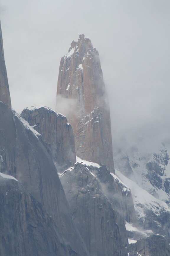
In the north of Pakistan, in the Baltoro Muztagh mountains and not far from K2, the Trango Towers feature several of the most significant granite cliffs in the world.  The eastern face of the Great Trango Tower, the highest peak in the group, features the largest “nearly vertical” drop in the world: 1,340 metres, but not with the true vertical drop of Mount Thor.


Looking across the Baltoro glacier, the Trango group are on the left of this picture.  Image via Evert Wesker.


Great Trango Tower.  Image via Askole treks.

The image of those towers rising up out of the Baltoro glacier is very impressive; especially when you consider that the glacier itself is up at 4,000m and yet they still rise a kilometre above that.  What really caught my eye was that among this group of mountains is one particularly striking peak with the equally striking name of Nameless Tower.


No attribution, but image found via these forums.


Image via Todd Skinner


Image via Todd Skinner

Anything that we might call ‘nameless’ immediately brings Lovecraft to mind.  Those towering cliffs all remind me greatly of scenes from Lovecraft’s The Dream-Quest of Unknown Kadath (I must get around to reading At the Mountains of Madness, which I imagine is rife with these places).  The Plateau of Leng and the mountains separating it from Inganok, the mountain Ngranek (although that was a solitary extinct volcano), even the great carved mountains that protect Kadath.  And there is also the granite island that was referred to as “that nameless rock”:

On the twentieth day a great jagged rock in the sea was sighted from afar, the first land glimpsed since Aran’s snowy peak had dwindled behind the ship. Carter asked the captain the name of that rock, but was told that it had no name and had never been sought by any vessel because of the sounds that came from it at night. And when, after dark, a dull and ceaseless howling arose from that jagged granite place, the traveller was glad that no stop had been made, and that the rock had no name. The seamen prayed and chanted till the noise was out of earshot, and Carter dreamed terrible dreams within dreams in the small hours.

That final image of Nameless Tower by night, with that lonely light peering out, gives me the distinct feeling of a place where people are not meant to be, where we are not welcome.  In a sense, the advances that climbing technique and equipment have made that allows them to scale all of these places – so that now the challenge is to find newer, more difficult ascents – has removed some of the feeling that people must have had in previous generations of places that were simply inaccessible, mysteries that could only be penetrated in the imagination.

Thursday, January 6, 2011

Mount Thor–the world’s tallest vertical drop

There are times when the landscapes in movies, art, or games give me the feeling that the artists and animators had too much time on their hands.  “Come on,” I think, “look at those ridiculous mountains.  Real mountains are impressive enough, why make them so unrealistic?”  And then you see something from our very own world that makes you realise that those images aren’t so fanciful after all.

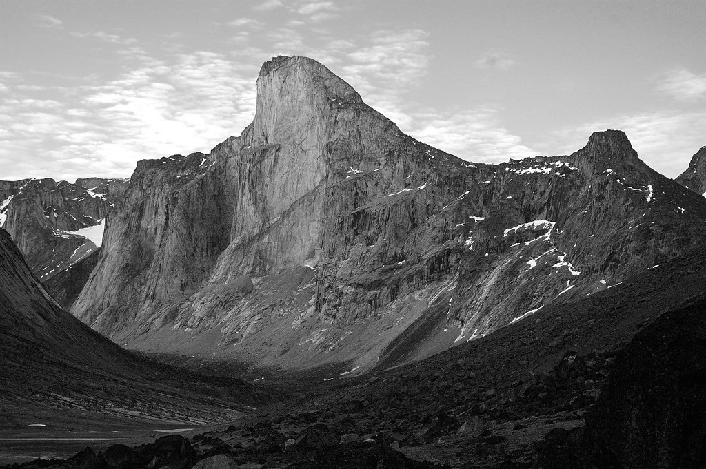
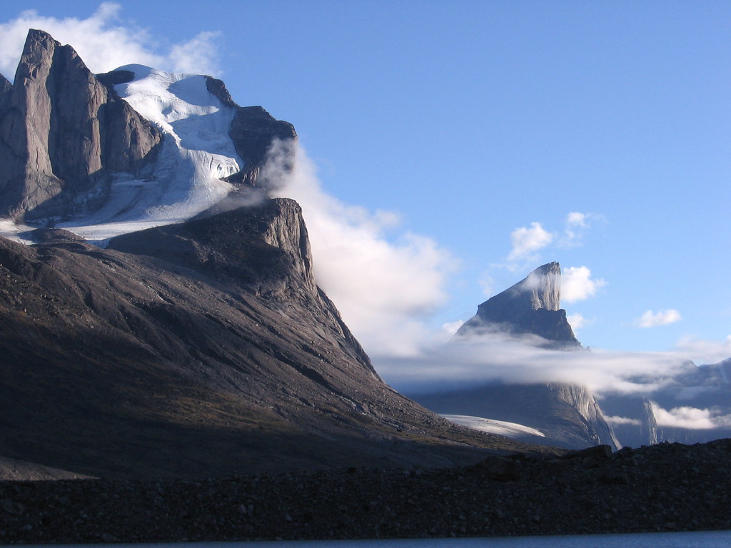
Mount Thor on Baffin Island (part of Nunavut in Canada) is a 1675m (~5500ft) granite peak that features the world’s tallest purely vertical drop.  At an average angle of 105 degrees, it is more than simply vertical – it is an overhang.  It cuts into the air like a mighty hooked thorn or knife, towering over the broad glacial valley below.


Mount Thor, viewed from the north (I believe)


Again, viewed from the north.  Note that the figures in the foreground are considerably closer to the camera than the mountain is.


Viewed from the south


Further back to the north, Nana Peak in the foreground.

The vertical drop totals some 1250m (4100ft).  Put in context, the Eiffel Tower is 324m, the Empire State Building is 381m, the CN Tower is 553m, and the Burj Khalifa 828m.

A magnificent prominence in a remote location, a wonderful setting for a game.  It would be a real challenge to bring the full sensation of this mountain to the table.  How do you make the players feel like they are under its shadow, or perched atop the peak?  Are words enough, or would it need pictures, or perhaps even a model?  If you put a 70cm tall clay model of the mountain on the table, then at that scale a 6ft tall character would be about 1mm.  Alternatively, if you’re playing with 28mm scale miniatures, Mount Thor’s drop is a little over 19m (64ft) tall – something like an eight-storey building.